![]() APR MAP
© DF8HL INFO E
APR MAP
© DF8HL INFO E
APRS PROGRAM / GPS NAVIGATION WITH MAPS IN UTM /
SWEREF99
FREE NAVIGATION (E.G. OVER WHOLE EUROPE) WITHOUT MAP
SHEET LIMITS
SCALE-CHANGING
( 2 m/p - 5000 m/p ) JUST BY A
SINGLE MOUSE CLICK
DIRECT CALL OF GOOGLE EARTH ON THE MAP
CENTER
INCLUDED: CONVERSION PROGRAM "RN2U33"
TRANSFORMS DATA AND MAPS FROM "RIKETS NÄT"
(=SWEDISH GRID) TO "SWEREF 99 TM" (=UTM ZONE 33)
FOR REG.
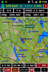
USERS: "APRMAP-A" GPS-/MAPPING-/APRS-OUTDOOR-APP FOR
ANDROID...
APR MAP
PROGRAM FUNCTIONS:
If you
connect a GPS receiver, NMEA0183-signals (GGA/GLL/RME) will provide your
own position every 5 seconds. Transmission and reception of APRS-signals is
done either via SOUNDCARD (program parts of AGWPE are included), by a SCS-DSP-TNC
or SCS-PTC-II with PR-capability (even Robust Packet Radio), a PK-232,
or a TNC via AGWPE. Besides of that there is the possibility to monitor
stations via INTERNET.
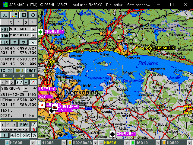
The
program shows your position and all APRS-stations received on HF, VHF, or
internet (even simultaneously) on the map. You can see symbols, callsigns and
tracks. You can chose different symbol characters and other display features
from simple symbol to complex information line (even UI-View-symbols and info
text).
A
WX-decoder shows the weather situation with data and symbols, and you can
transmit weather- telemetry- or other data from files generated by other
programs.
Of
course you can observe the native Packet Radio text directly in a switchable
RX-window.
Besides
displaying all stations you can select one station for main monitoring (MONI
1), whose positions will be saved in log-files. So you can look up the saved
position informations even after days.
You
can also display your own travel activities (tracks), points of interest, as
well as coordinate-related images and videos.
In
addition to the exchange of small chat-messages you can chose an auto-answer
mode.
Of
course you can digipeat and registered users can use a simple IGate function
(RF>INET).
All
functions are provided with rich Quick-Info help texts in English, German and
Swedish.
The
most important difference to other well-known APRS-programs is the fact,
that APR MAP uses rectangular map projections like UTM or SWEREF 99 TM (the
new swedish reference system). Doing this, it works perfectly with maps
derivated from those published by many
national land survey authorities (e.g. "Lantmäteriet"). So it is very
easy to make your own maps for APR MAP.
This is allowed for personal use only!
|
SCALES |
MAP TYPES |
|
|
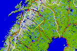
5000 meters/pixel |
Very rough map included in the program covering much more than Europe (© DF8HL) Free version: Normal map, Reg. version: Normal map / Shaded relief |
|
|
1000 meters/pixel |
Rough map included in the program covering Europe (© DF8HL) Free version: Normal map, Reg. version: Normal map / Shaded relief |
|
|
200 meters/pixel |
Main parts of Europe, 1 file included, all other maps as free download (© DF8HL) Free version: Normal map, Reg. version: Normal map / Shaded relief |
|
|
50
meters/pixel |
Source: E.g. Översiktskartan (© Lantmäteriet), 1 demo file included with instruction "how
to" Free version: Limit to a maximum of 10
files, Reg. version: no limitation, many maps downloadable |
|
|
10
meters/pixel |
Source: E.g. Terrängkartan (© Lantmäteriet), 1 demo file included with instruction "how
to" Free version: Limit to a maximum of 10
files, Reg. version: No limitation, many maps downloadable |
|
|
2 meters/pixel |
Source: E.g. aerial photos (© Lantmäteriet), 1 demo file included with instruction "how
to" Free version: Limit to a maximum of 10
files, Reg. version: No limitation, many maps downloadable |
|
Size of single
map files: 1000x1000 pixels.
Projection
identification: By folder name, e.g. U33, or U08 etc.
Scale
identification: By subfolder name, e.g. M0200 for 200m/p maps
Location
identification: By filename (SW-corner), e.g. 67500400.BMP = 6750.000 N,
400.000 E in the actual rectangular system.
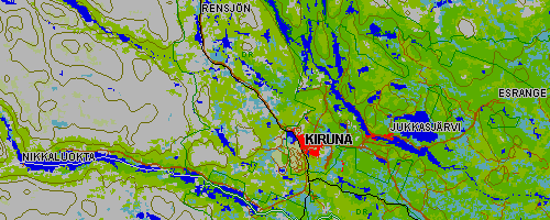
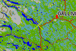
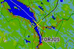
Example
Nikkaluokta-Kiruna-Jukkasjärvi-Esrange: Normal map
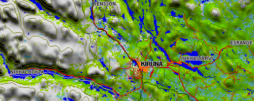
Example
Nikkaluokta-Kiruna-Jukkasjärvi-Esrange: Shaded relief
APR
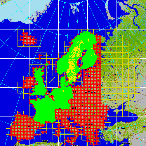
MAP can handle huge amounts of maps - and extremely fast too.
Here
is a standard maps overview (about 39000 maps):
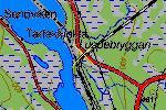
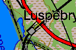
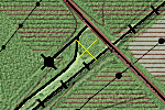
SCREENSHOTS
The
collection of screenshots shows the display with different types of maps and
program functions
![]() APR MAP /
APR MAP -A screenshots ( 1.6 MB )
APR MAP /
APR MAP -A screenshots ( 1.6 MB )
SYSTEM REQUIREMENTS
APR
MAP works on 32- and 64-bit WINDOWS™ PC systems.
I
testet it myself on WINDOWS
98SE, ME, 2000, XP-32, 7-32, 8-64, 10-64. Some users even run it on Vista-32
and 7-64. On slow systems (below some hundred MHz), and in a few
special cases, soundcard interfacing might not work. If you can report
interesting observations related with this program and its compatibility, let
me know about it: DF8HL@arcor.de.
FREE VERSION OR REG. VERSION ?
You
are invited to use the freeware version without any time limitation as
much as you like. I whish you a lot of pleasure with that program. On the other
hand - making all program- and map files for the full version available, means
a lot of work and money. That's why you have to pay the full version
with a registration fee of 30 € once (including free update-service and
access to the APRMAP-Server and the GPS outdoor app for Android APRMAP-A).
If you want to purchase the full version, write a short e-mail including name,
address, callsign (or other wanted user name) to DF8HL@arcor.de. Downloads for the free version are
located here: